

After Luderitz we drove to the Fish River Canyon National Park which is centrally located in the southern tip of Namibia. We enjoyed the drive, although we were disappointed that the groups of ostrich we had seen previously on the Aus-Luderitz road had apparently left the area. The drive was a total of about 4 hours and it brought us through some very scenic and rural areas.
Our lodge was situated on the western rim of the canyon at a very nice scenic location there. This option was off the beaten path so to speak, and this location suited us well for our Fish River Canyon accommodation.

Geological Facts About the Fish River Canyon
It is the largest canyon in Africa and the Fish River is the largest interior river in Namibia. The geological history of the canyon began when the Fish River started flowing along the base of a graben. The graben was formed through tectonic processes about 650 million years ago. An additional source of erosion that helped carve out the canyon initially was glaciation. The glaciers occurred about 300 million years ago during the Karoo ice ages.
Today, the canyon features a spectacular ravine that is up to 160 kilometers long, 27 kilometers wide and 550 meters deep. The river flows intermittently and the water mostly remains pooled in the riverbed until the start of the rainy season. In Southern Namibia, the rainy season starts in November and goes through March. If the rains are favorable, the Fish River river flows south until it meets its confluence with the Orange River. The Orange River then flows west along Namibia’s southern border with South Africa.
Upper Canyon vs Lower Canyon
The Fish River Canyon consists of an older upper canyon and a younger lower canyon. The upper canyon is very wide closer to the top of the canyon walls. This is because of the Fish River encountering very hard layers of gneiss bedrock.
As a result of the gneiss formation, the downward erosion process was slowed significantly. This compelled the river to meander and caused lateral erosion at the higher levels of the canyon wall. By the time the Fish River was finally able to break through the more impermeable gneiss formations, it had widened the upper reaches of the canyon significantly.
The ability of the river to break through the more resistant layers of rock was helped along by the break up of the Gondwana Continent. The South American land mass broke away from Africa about 120 million years ago. This caused the western edge of Africa to rise and increased the elevation of the land in the surrounding area. The increased elevation raised the river’s gradient and made the incising of the river water through the stubborn gneiss formations much more effective.

Recreation Activities on the Eastern Rim
There are trails running along the canyon floor and also the eastern rim of the canyon. As a result, the opportunities for a nice Fish River Canyon hike are infinite. Additionally, the photo opportunities are prolific and it is a great time to soak in the flora and fauna of the area.
The trails running through the base of the canyon can be accessed on the eastern side near Hobas. The longest hike runs 88 kilometers and follows the Fish River through the canyon.
The trail eventually passes through the Ai-Ais which is the location of a naturally occurring hot spring. Ai-Ais means “burning water” in the Nama dialect. There is accommodation in Ai-Ais and there is also a shuttle service if you are not interested in the long hike in.
We did not indulge in any activities on the eastern rim of the canyon hike on our recent trip. However, it is indeed very popular with other visitors. The activities in the area also include an annual “ultra” marathon that follows the path of the trail through the bottom of the canyon.

Activities on the Western Rim
Our Fish River Canyon lodge featured a daily 4×4 drive down into the canyon and my friend chose to venture along the next day. I would have much preferred to drive down myself. However, this was not advisable without local knowledge of the route.
I chose not to go along but not because it wasn’t possible to take my own 4×4 vehicle. Rather, it was because a plane load of buffoonish Belgian tourists had flown in the day before. I would not risk being stuck in close quarters with them for a long hot bumpy drive to the canyon floor. Fortunately, there were some other activities to indulge in on the western rim.
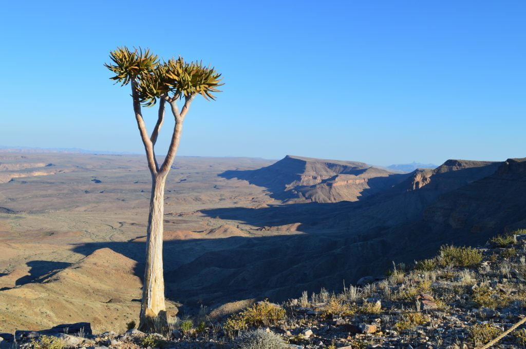
As an alternative, I spent the day hiking along the upper rim of the western canyon wall. Additionally, I took the 4×4 out for a spin and explored a couple of the local look out points that were situated along the top of the canyon. The desert flora and fauna is excellent and I enjoyed taking an HD video. I can’t speak enough about the excellent photography opportunities in this area.
The Long Drive from Fish River Canyon to Windhoek
Unfortunately, all good things must end eventually. The next day we were driving all the way to Windhoek to stay the night. Then we were driving from Windhoek to Etosha National Park. We would be spending 3 days exploring the number one attraction in Namibia.
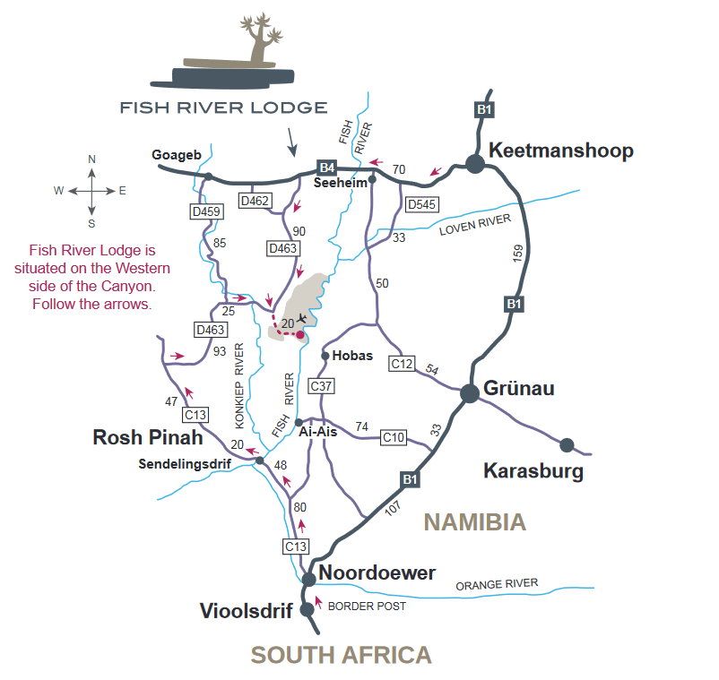
The drive back to Windhoek was hell, to put it mildly. From the Fish River Canyon lodge, back to B4, then B4 east to Keetmanshoop and then B1 north all the way to Windhoek.The Fish River Canyon map below should help put things into perspective.
The final stretch from Keetmanshoop to Windhoek was the worst of it. It is the most boring, straight road in the world. It is very difficult not to nod off while driving. There are really no redeeming aspects of the drive. I was glad to finally get it over with and we were both really looking forward to exploring Etosha National Park over the next few days.
Namibia – Fascination of Geology
A Travel Handbook
Nicole Grunert